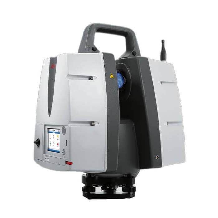

Leica ScanStation P50 – Long Range 3D Terrestrial Laser Scanner
Unlike any other laser scanner, the Leica ScanStation P50 solution maximises productivity by scanning inaccessible places at a safe position on site, reducing time in the field with less setups.
MME Shopping Event
Hurry and get discounts on Most of MME Products up to 20%
Call for Price
Leica ScanStation P50 – Long Range 3D Terrestrial Laser Scanner
For industry professionals looking to scan inaccessible places and find new business opportunities, Leica ScanStation P50 is the fastest and safest, long-range 3D laser scanner. Unlike any other laser scanner, the P50 solution maximizes productivity by scanning inaccessible places at a safe position on site, reducing time in the field with fewer setups.
leica scanstation p50 3d laser scanner
As part of the Leica Geosystems 3D Reality Capture solution, the Cyclone FIELD 360 app links the 3D data acquisition in the field with the ScanStation P50 laser scanner and final data registration in the office with Cyclone REGISTER 360. One-site, users can now automatically capture, register and examine scan and image data.
Leica ScanStation P50 – the long-range terrestrial 3D laser scanner is an advanced technology that has changed the way we survey, map and collect data. With its superior performance and innovative features, the Leica ScanStation P50 has become a popular choice among surveyors, engineers, and other professionals.
The Leica ScanStation P50 is equipped with an ultra-high-speed scanner capable of capturing data at an impressive speed of up to 1 million points per second. This feature allows users to scan large areas in minutes, much faster than traditional surveying methods. In addition, the P50 is designed to deliver high-quality data with exceptional accuracy and precision, which is essential for projects that require precise measurements.
Another important benefit of the Leica ScanStation P50 is its versatility. The device can be used in a variety of applications including civil engineering, civil engineering, architectural design, and heritage preservation. The P50 can collect data from a distance of up to 1 kilometer, making it ideal for large projects.
Leica ScanStation P50 – Long Range 3D Terrestrial Laser Scanner Specifications:
- Power supply: 24 V DC, 100 – 240 V AC
- Operating temperature: –20°C to +50°C / –4°F to +122°F
- Storage temperature: –40°C to +70°C / –40°F to +158°F
- Humidity: 95%, non-condensing
- Dimensions:(D×W×H) 238mm × 358mm × 395mm / 9.4” × 14.1” × 15.6
- Weight: 12.25kg
1 review for Leica ScanStation P50 – Long Range 3D Terrestrial Laser Scanner
Clear filtersYou must be logged in to post a review.
Brand
Leica
Leica
Leica Geosystems creates complete solutions for professionals around the world. Revolutionising the world of measurement and survey for 200 years, Leica Geosystems, part of Hexagon, creates complete solutions for professionals across the planet. Known for premium products and innovative solution development, professionals in a diverse mix of industries, such as aerospace and defence, safety and security, construction, and manufacturing, trust Leica Geosystems for all their geospatial needs. With precise and accurate instruments, sophisticated software, and trusted services, Leica Geosystems delivers value every day to those shaping the future of our world.

 Specifications
| Mechanical and General Specifications | ||||||||||
|---|---|---|---|---|---|---|---|---|---|---|
| ||||||||||
Related Products
Fluke 424D : an Epic Laser Distance Meter
In stock
Fluke 417D Laser Distance Meter
In stock
EXTECH DT100M Laser Distance Meter
In stock
UNI-T LM100 Laser Distance Meter
In stock


mike –
Excellent customer service, very helpful and friendly