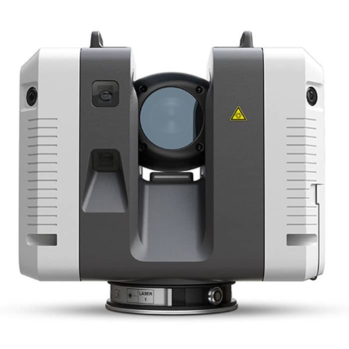

Leica RTC360 3D Laser Scanner
The Leica RTC360 3D-reality capture solution empowers users to document and capture their environments in 3D, improving efficiency and productivity in the field and in the office through fast, simple-to-use, accurate, and portable hardware and software.
To buy Leica RTC360 and get more information about it contact us through mme.
MME Shopping Event
Hurry and get discounts on Most of MME Products up to 20%
Call for Price
Leica RTC360 3D Laser Scanner
The Leica RTC360 3D reality capture solution empowers users to document and capture their environments in 3D, improving efficiency and productivity in the field and in the office through fast, simple-to-use, accurate, and portable hardware and software. The RTC360 3D laser scanner is the solution for professionals to manage project complexities with accurate and reliable 3D representations and discover the possibilities of any site.
Highly portable, highly automated, intuitive, and designed for maximum productivity, the RTC360 solution efficiently combines the RTC360 a high-performance 3D laser scanner, and Leica Cyclone FIELD 360 mobile-device app for edge computing for automatically registering scans in real-time.
Capture scans, including enriching High-Dynamic Range (HDR) imagery, in less than two minutes. Automatically record your moves from station to station to pre-register your scans in the field without manual intervention.
Augment your data capture with information tags illustrating the opportunities for better planning, reflecting site reality, and boosting your teams’ situational awareness. Directly publish your captured data from Cyclone FIELD 360 to Leica TruView Cloud to quickly exchange project information prior to import and registration.
Leica-RTC360 3D Reality Capture Solution
Benefits of Leica RTC360
3D reality capture is now faster than ever thanks to the new Leica RTC360 laser scanner. The production of colored 3D point clouds can be finished in under two minutes using a sophisticated HDR photography system and a measuring rate of up to 2 million points per second. Additionally, targetless field registration that is automated (based on VIS technology) and the automatic, smooth transfer of data from the site to the office save time spent in the field and increase productivity.
Leica Geosystems RTC360 Features
- Highly portable, highly automated, intuitive, and designed for maximum productivity
- Capture scans
- Automatically record your moves from station to station to pre-register your scans in the field without manual intervention.
- Augment your data capture with information tags illustrating the opportunities for better planning, reflect site reality, and boost your teams’ situational awareness
- Directly publish your captured data from Cyclone FIELD 360 to Leica TruView Cloud to quickly exchange project information prior to import and registration
Leica RTC360 3D Laser Scanner Specifications:
- Dimensions: 120 mm x 240 mm x 230 mm / 4.7‘‘ x 9.4‘‘ x 9.1‘‘
- Weight: 5.35 kg / 11.7 lbs
- Operating temperature : -5° to +40°C
- Storage temperature: -40° to +70°C
You must be logged in to post a review.
Brand
Leica
Leica
Leica Geosystems creates complete solutions for professionals around the world. Revolutionising the world of measurement and survey for 200 years, Leica Geosystems, part of Hexagon, creates complete solutions for professionals across the planet. Known for premium products and innovative solution development, professionals in a diverse mix of industries, such as aerospace and defence, safety and security, construction, and manufacturing, trust Leica Geosystems for all their geospatial needs. With precise and accurate instruments, sophisticated software, and trusted services, Leica Geosystems delivers value every day to those shaping the future of our world.

 Specifications
Related Products
EXTECH DT500 Laser Distance Meter with Bluetooth
In stock


Reviews
Clear filtersThere are no reviews yet.