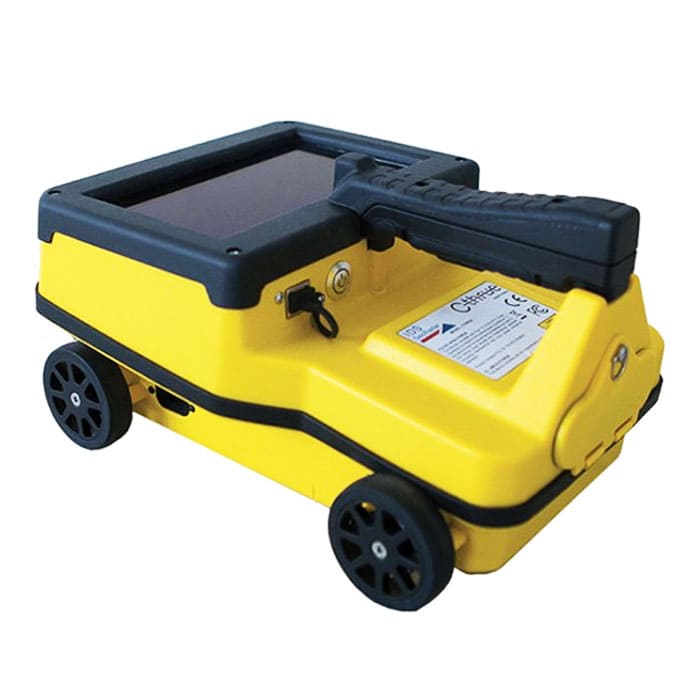
Concrete Scanner C-Thrue
The concrete scanner C-thrue is an easy-to-use and robust solution to see through concrete structures and reveal true data that lead to optimal decision-making.
MME Shopping Event
Hurry and get discounts on Most of MME Products up to 20%
Call for Price
Concrete Scanner C-Thrue
The concrete scanner C-thrue is an easy-to-use and robust solution to see through concrete structures and reveal true data that lead to optimal decision-making. The solution is suited for all construction sites and operations including building renovation, overpasses, monuments, bridges and tunnels surveys, as well as for detailed analysis of the original engineering project and comparison with the as-built structure.
C-thrue offers more flexibility with no limitations for your analysis requirements, thanks to a compact and light telescopic pole and an external controller that can be easily transported on site in challenging locations or conditions (e.g. under a deck, under ceilings, over floors, on walls, etc…).
The C-thrue external controller allows easier and faster data interpretation thanks to real-time data processing and representation of results in Augmented Reality for more efficient decision-making.
Concrete Scanner C-Thrue Specifications:
- Antenna center frequency: 2.0 GHz
- Dimensions (length x width x height) 285mm x 200mm x 160mm, (11,2in x 8,6in x 6,3in)
- Weight 2.4 kg (5 lb) with battery
- Scan interval: Up to 10 scans/cm
- Depth range: Up to 80 cm (up to 31.5 in.)
- Data storage: 32 GB
- Display: 7.0 inches TFT multi-touch
You must be logged in to post a review.
Brand
Leica
Leica
Leica Geosystems creates complete solutions for professionals around the world. Revolutionising the world of measurement and survey for 200 years, Leica Geosystems, part of Hexagon, creates complete solutions for professionals across the planet. Known for premium products and innovative solution development, professionals in a diverse mix of industries, such as aerospace and defence, safety and security, construction, and manufacturing, trust Leica Geosystems for all their geospatial needs. With precise and accurate instruments, sophisticated software, and trusted services, Leica Geosystems delivers value every day to those shaping the future of our world.

 Specifications
Related Products
FLUKE TiX580 Infrared Camera
In stock
Testo 890 FeverDetection Kit Thermal Imager X7
In stock
Fluke Ti401 PRO Thermal Camera
In stock
FLUKE PTi120 Compact Thermal Camera
In stock


Reviews
Clear filtersThere are no reviews yet.